Geolocate

Tasman topographic map

Click on the map to display elevation.

About this map

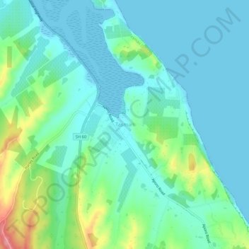
Name: Tasman topographic map, elevation, terrain.

Location: Tasman, New Zealand (-41.20911 173.03265 -41.16911 173.07265)

Average elevation: 25 m

Minimum elevation: 0 m

Maximum elevation: 112 m

Other topographic maps

Click on a map to view its topography, its elevation and its terrain.

Rolling River

New Zealand > Tasman

Average elevation: 539 m

Gear up for your next adventure:

🗺️Topographic Maps - Detailed maps to explore trails, mountains, and wilderness areas
🥾Trail Hiking Socks - Comfortable socks to prevent blisters and fatigue
🦟Insect Repellent - Keep mosquitoes and black flies away in wooded areas
🏕️Camping Hammock - Integrated protection for sleeping between trees
🧢Beanie Hat - Keep your head warm in cold weather

As an Amazon Associate, this site earns from qualifying purchases at no extra cost to you.