Geolocate

Hawea Point topographic map

Click on the map to display elevation.

About this map

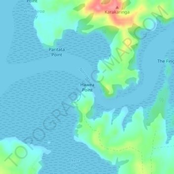
Name: Hawea Point topographic map, elevation, terrain.

Location: Hawea Point, Waikato District, Waikato, 3295, New Zealand (-37.79381 174.92253 -37.79371 174.92263)

Average elevation: 14 m

Minimum elevation: -1 m

Maximum elevation: 95 m

Gear up for your next adventure:

🔨Vehicle Emergency Tool - Safety tool for remote road trips to trailheads
🥾Waterproof Hiking Shoes - Durable shoes for wet and rugged trails
🧦Merino Wool Socks - Moisture-wicking comfort for long-distance hiking
🦶Hiking Shoe Insoles - Added support for high arches and long days on feet
🥾Hiking Gaiters - Protect legs and shoes from mud, snow, and debris

As an Amazon Associate, this site earns from qualifying purchases at no extra cost to you.