Geolocate

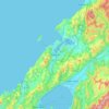
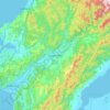
Waikato topographic map

Click on the map to display elevation.

About this map

Name: Waikato topographic map, elevation, terrain.

Location: Waikato, New Zealand (-39.30065 174.31374 -36.25825 176.50532)

Average elevation: 152 m

Minimum elevation: -1 m

Maximum elevation: 2,717 m

Other topographic maps

Click on a map to view its topography, its elevation and its terrain.
Waitara

New Zealand > Taranaki > New Plymouth District

Average elevation: 28 m

Haast Pass

New Zealand > West Coast > Westland District

Average elevation: 766 m

Duntroon

New Zealand > Canterbury > Waitaki District

Average elevation: 150 m

Scotsman Valley

New Zealand > Waikato > Waikato District

Average elevation: 108 m

Hope

New Zealand > Tasman

Average elevation: 71 m

Seton Peak

New Zealand > Otago > Queenstown-Lakes District

Average elevation: 1,375 m

Wyuna Bay

New Zealand > Waikato > Coromandel > Wyuna Bay

Average elevation: 12 m

Wānaka

New Zealand > Otago > Queenstown-Lakes District

Average elevation: 381 m

Hibiscus Coast

New Zealand > Auckland

Average elevation: 40 m

Greymouth

New Zealand > West Coast > Grey District

A combination of high intensity rainfall, high topographic relief and short steep rivers often leads to rapid flooding of low-lying land across the West Coast. Since its founding Greymouth has experienced two dozen floods by the Grey River, with many of the most significant being assigned names: for example,…

Average elevation: 40 m
Geraldine

New Zealand > Canterbury > Timaru District

Average elevation: 130 m

Hawea Point

New Zealand > Waikato > Waikato District

Average elevation: 14 m

Point Erin

New Zealand > Auckland > Auckland

Average elevation: 9 m

Porirua

New Zealand > Wellington > Porirua City

Average elevation: 115 m

Tasman

New Zealand > Tasman

Average elevation: 25 m

Cardrona

New Zealand > Otago > Queenstown-Lakes District

Average elevation: 758 m

Blake

New Zealand > Wellington > Masterton District

Average elevation: 568 m

Upper Hutt

New Zealand > Wellington > Upper Hutt City

Average elevation: 271 m

Eureka

New Zealand > Waikato > Waikato District

Average elevation: 49 m

Barometer

New Zealand > Marlborough

Average elevation: 1,397 m

Selwyn

New Zealand > Canterbury > Selwyn District

Average elevation: 70 m

Gear up for your next adventure:

👖Convertible Hiking Pants - Zip-off legs to adapt to changing weather conditions
🧳Compression Sacks - Maximize space in your backpack by shrinking gear
🥾Approach Boots - Comfortable boots for hiking and climbing approaches
🕶️Polarized Sunglasses - Reduces glare from snow and water at high elevations
🧢Hiking Sun Hat - Wide-brimmed protection for exposed mountain ridges

As an Amazon Associate, this site earns from qualifying purchases at no extra cost to you.