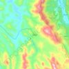
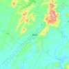
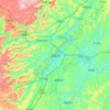
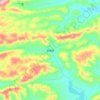
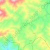
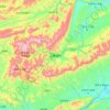
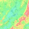
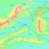
Guidong County topographic map
Click on the map to display elevation.
Guidong County
Guidong County belongs to the subtropical monsoon humid climate zone, no summer heat, no winter cold, warm and humid, four seasons. In spring, the southeast wind into the cold and warm air masses fronts in the territory of the confrontation hovering, insufficient light, cloudy temperature and rain. In summer, controlled by the low latitude ocean warm and humid air masses, high temperature and rainy, prevailing south wind. However, the territory is high in altitude, mountainous, and has good vegetation, so the summer dollar heat. Under the influence of typhoons, there are sometimes torrential rains. In autumn, the cold air invasion, the temperature drops, cold air activity is frequent, less rain, often high autumn weather. Occasionally, it is affected by typhoons and there are heavy rainfalls from time to time. In winter, under the control of dry and cold air masses from the north, there are often cold currents intruding from Siberia and the Mongolian Plateau, but because of the high mountains, the terrain is tilted to the south, and thus the winter is not too cold.
About this map

Name: Guidong County topographic map, elevation, terrain.
Location: Guidong County, Chenzhou, Hunan, China (25.73329 113.61743 26.21795 114.23190)
Average elevation: 887 m
Minimum elevation: 193 m
Maximum elevation: 2,027 m
Other topographic maps
Click on a map to view its topography, its elevation and its terrain.




Zhangjiajie Tianmen Mountain National Forest Park
China > Hunan > Yongding District
Average elevation: 781 m
Zhangjiajie Tianmen Mountain National Forest Park
China > Hunan > Yongding District
Average elevation: 781 m

Ningxiang
China > Hunan > Ningxiang > Yutan Subdistrict
The highest natural elevation in Ningxiang County is 1071m at Wazizhai (瓦子寨).
Average elevation: 83 m