Geolocate

Chenzhou topographic map

Click on the map to display elevation.

About this map

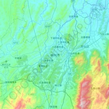
Name: Chenzhou topographic map, elevation, terrain.

Location: Chenzhou, Beihu District, Chenzhou, Hunan, 423000, China (25.61336 112.84943 25.93336 113.16943)

Average elevation: 364 m

Minimum elevation: 120 m

Maximum elevation: 1,600 m

Gear up for your next adventure:

🧦Outdoor Socks - Durable socks designed for hiking and outdoor sports
🧤Thermal Hiking Gloves - Grip-enhanced gloves for cold-weather altitude trekking
🥤Collapsible Travel Cup - Saves space and weight in your mess kit
🪑Ultralight Camping Stool - Compact seating for rest stops during long hikes
🔦LED Headlamp - Hands-free lighting for early morning starts or late finishes

As an Amazon Associate, this site earns from qualifying purchases at no extra cost to you.