Geolocate

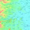
Mengquan topographic map

Click on the map to display elevation.

About this map

Name: Mengquan topographic map, elevation, terrain.

Location: Mengquan, Changde, Hunan, China (29.37495 111.43399 29.45495 111.51399)

Average elevation: 84 m

Minimum elevation: 57 m

Maximum elevation: 224 m

Other topographic maps

Click on a map to view its topography, its elevation and its terrain.
Shimen County

China > Hunan > Changde

Average elevation: 407 m

Li County

China > Hunan > Changde

Average elevation: 104 m

Wuling District

China > Hunan > Changde

Average elevation: 52 m

Gear up for your next adventure:

⛺Camping Groundsheet - Protect your tent from moisture and dirt
🧥Softshell Jacket - Windproof and breathable jacket for hiking
🥾Hiking Shorts - Breathable shorts suitable for summer hikes
🛏️Camping Sleeping Mat - Comfortable mats for sleeping outdoors
🧥Waterproof Pants - Keep dry during rainy hiking conditions

As an Amazon Associate, this site earns from qualifying purchases at no extra cost to you.