Geolocate

Ningxiang topographic map

Click on the map to display elevation.

Ningxiang

The highest natural elevation in Ningxiang County is 1071m at Wazizhai (瓦子寨).

Wikipedia (CC-BY-SA 3.0)

About this map

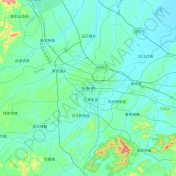
Name: Ningxiang topographic map, elevation, terrain.

Location: Ningxiang, Yutan Subdistrict, Ningxiang, Changsha, Hunan, China (28.11941 112.38657 28.43941 112.70657)

Average elevation: 83 m

Minimum elevation: 29 m

Maximum elevation: 481 m

Gear up for your next adventure:

🥾Mountain Hiking Boots - High-traction boots for rocky terrain
🧼Biodegradable Camp Soap - Environmentally friendly cleaning for gear and body
Camping Essentials - All-in-one gear for a comfortable camping trip
🧊Insulated Water Bottle - Keeps drinks cold in summer and prevents freezing in winter
🥾Waterproof Hiking Boots - Essential footwear for rugged terrain and wet Canadian trails

As an Amazon Associate, this site earns from qualifying purchases at no extra cost to you.