Geolocate

Pule topographic map

Click on the map to display elevation.

About this map

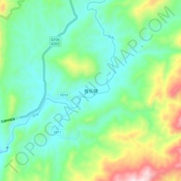
Name: Pule topographic map, elevation, terrain.

Location: Pule, Chenzhou, Hunan, China (25.83570 113.83500 25.91570 113.91500)

Average elevation: 850 m

Minimum elevation: 618 m

Maximum elevation: 1,460 m

Gear up for your next adventure:

🔭Outdoor Binoculars - Lightweight binoculars for birdwatching and hiking
🧴First Aid Kit - Essential first aid supplies for outdoor emergencies
🚲Heavy Duty Bike Lock - Secure your bike at the trailhead or during stops
🧥Ultralight Puffy Jacket - Maximum warmth that packs down to the size of an orange
🧊Insulated Water Bottle - Keeps drinks cold in summer and prevents freezing in winter

As an Amazon Associate, this site earns from qualifying purchases at no extra cost to you.