Geolocate

Gaobu topographic map

Click on the map to display elevation.

About this map

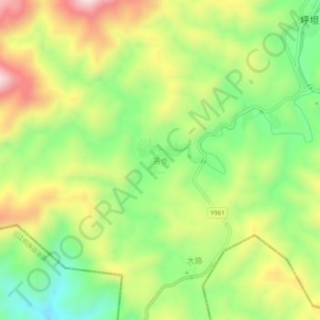
Name: Gaobu topographic map, elevation, terrain.

Location: Gaobu, Tongdao Dong Autonomous County, Huaihua, Hunan, China (26.00659 109.67027 26.04659 109.71027)

Average elevation: 497 m

Minimum elevation: 279 m

Maximum elevation: 774 m

Gear up for your next adventure:

🧢Sun Hat - Wide-brim hat for sun protection
💧Hydration Pack - Hands-free hydration system for long hikes
🥾Waterproof Hiking Shoes - Durable shoes for wet and rugged trails
🛶Waterproof Dry Bags - Keep electronics and clothes dry during river crossings
🧢Hiking Sun Hat - Wide-brimmed protection for exposed mountain ridges

As an Amazon Associate, this site earns from qualifying purchases at no extra cost to you.