Aragon topographic maps
Click on a map to view its topography, its elevation and its terrain.
Sabiñánigo
Spain > Aragon > Alto Gállego
Sabiñánigo (Samianigo in Aragonese) is a municipality located in the province of Huesca, Aragón, Spain, capital of the comarca of Alto Gállego. Formerly, the region was called Serrablo, hence the demonym "serrablese". Sabiñánigo is at an altitude of 780 m and lies 52 km from Huesca.
Average elevation: 1,211 m
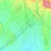
Huesca
Spain > Aragon > Hoya de Huesca / Plana de Uesca
Huesca lies on a plateau in the northern region of Aragón, with an elevation of 488 m (1,601 ft) above sea level. Close to the city lie the Sierra de Guara mountains, which reach 2,077 m. The geographical coordinates of the city are: 42° 08´ N, 0° 24´ W.
Average elevation: 528 m

Zaragoza
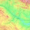
On 1 January 2019 the population of the city of Zaragoza was 706,904, within its administrative limits on a land area of 1,062.64 square kilometres (410.29 square miles), ranking fifth in Spain. It is the 32nd most populous municipality in the European Union. The population of the metropolitan area was…
Average elevation: 701 m


Alconchel de Ariza
Spain > Aragon > Comunidad de Calatayud > Alconchel de Ariza
Average elevation: 905 m


Vicario
Spain > Aragon > Cinco Villas > Ejea de los Caballeros > Ejea de los Caballeros
Average elevation: 329 m


Urrea de Gaén
Located in the Lower Martin river area, in the Ebro basin, at the left bank of the Martin river, at 308 meters of elevation. It lies 160 km away from Teruel, the province capital, and 75 km away from Zaragoza, capital of the community.
Average elevation: 342 m


Santa María de la Peña
Spain > Aragon > Hoya de Huesca / Plana de Uesca > Las Peñas de Riglos
Average elevation: 682 m


Santa Eulalia la Mayor
Spain > Aragon > Hoya de Huesca / Plana de Uesca > Loporzano
Average elevation: 790 m

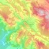

Manzanera
Spain > Aragon > Gúdar-Javalambre
Manzanera is a settlement located in the South of Aragon, at an altitude of 960 m (3,150 ft) above sea level in the Sierra de Javalambra, where the tallest point of the province is located as well as one of the tallest of the Iberian System, near the Province of Castellón. It enjoys a continental…
Average elevation: 1,224 m




Sistema Ibérico
Spain > Aragon > Tarazona y el Moncayo > Tarazona
The geology of the Iberian System is complex, for it can hardly be defined as a homogeneous system. It is composed of a haphazard and motley series of mountain ranges, massifs, plateaus and depressions without a definite common petrologic composition and overall structure. Nummulite limestone, marble and…
Average elevation: 1,906 m










Riglos
Spain > Aragon > Hoya de Huesca / Plana de Uesca > Las Peñas de Riglos
Average elevation: 726 m





Daroca
Spain > Aragon > Campo de Daroca
The climate in Daroca is cold semi-arid (BSk) bordering on a humid subtropical climate (Cfa) under the Köppen classification. It has an oceanic with hot summer and cool winter (Doak) under the Trewartha classification. This type of climate is common in inland Spain, with low annual rainfall and high summer…
Average elevation: 866 m


Valdelinares
Spain > Aragon > Gúdar-Javalambre
The elevation of the village is 1,690 metres (5,540 ft) above sea level, making this town the highest in Peninsular Spain among those which are the seat of a municipality.
Average elevation: 1,723 m






Almudévar
Spain > Aragon > Hoya de Huesca / Plana de Uesca
The relief of the municipality is predominantly flat, and includes part of the Llanos de la Violada. The altitude oscillates between 603 meters north (Saso Plano) and 390 meters south. The town is 456 m above sea level.
Average elevation: 429 m