Geolocate

Ruesta topographic map

Click on the map to display elevation.

About this map

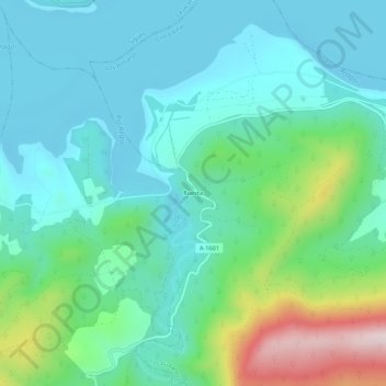
Name: Ruesta topographic map, elevation, terrain.

Location: Ruesta, Urriés, Cinco Villas, Zaragoza, Aragon, Spain (42.56882 -1.09616 42.60882 -1.05616)

Average elevation: 588 m

Minimum elevation: 477 m

Maximum elevation: 961 m

Gear up for your next adventure:

🥾Trail Hiking Boots - Supportive boots for rough trails
🎒Hiking Backpack - Lightweight and ergonomic backpacks for day hikes or multi-day treks
🗺️Topographic Maps - Detailed maps to explore trails, mountains, and wilderness areas
💧Collapsible Water Bottle - Space-saving water bottle for outdoor activities
🧥Fleece Jacket - Warm and lightweight jacket for layering

As an Amazon Associate, this site earns from qualifying purchases at no extra cost to you.