Geolocate

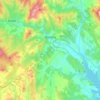
Griebal topographic map

Click on the map to display elevation.

About this map

Name: Griebal topographic map, elevation, terrain.

Location: Griebal, Aínsa-Sobrarbe/L'Aínsa-Sobrarbe, Sobrarbe, Huesca, Aragon, 22337, Spain (42.36465 0.18305 42.40465 0.22305)

Average elevation: 665 m

Minimum elevation: 506 m

Maximum elevation: 1,009 m

Other topographic maps

Click on a map to view its topography, its elevation and its terrain.
Boltaña

Spain > Aragon > Sobrarbe

Average elevation: 860 m

Gear up for your next adventure:

🔋Emergency Crank Radio - Weather alerts and power without needing batteries
🕶️Polarized Sunglasses - Reduces glare from snow and water at high elevations
🛌Down Sleeping Bag - Superior warmth-to-weight ratio for cold nights
🛏️Sleeping Bag - Warm and compact sleeping bags for outdoor camping
🥾Waterproof Hiking Boots - Essential footwear for rugged terrain and wet Canadian trails

As an Amazon Associate, this site earns from qualifying purchases at no extra cost to you.