Geolocate

San Agustín topographic map

Click on the map to display elevation.

About this map

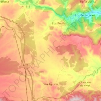
Name: San Agustín topographic map, elevation, terrain.

Location: San Agustín, Gúdar-Javalambre, Teruel, Aragon, 44480, Spain (40.04222 -0.72929 40.14396 -0.61359)

Average elevation: 919 m

Minimum elevation: 631 m

Maximum elevation: 1,149 m

Gear up for your next adventure:

🧥Waterproof Hiking Jacket - Protect yourself from rain and wind while hiking
🌬️Windproof Camp Stove - Efficient cooking even on exposed mountain peaks
Bushcraft Tarp - Versatile emergency shelter or gear protection
💡Compact LED Flashlight - Powerful and portable flashlight for outdoor use
💡Solar Camping Lamp - Eco-friendly lighting for campsites

As an Amazon Associate, this site earns from qualifying purchases at no extra cost to you.