Geolocate

Bielsa topographic map

Click on the map to display elevation.

About this map

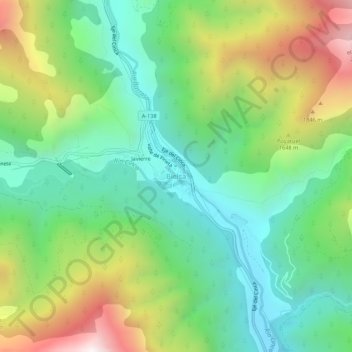
Name: Bielsa topographic map, elevation, terrain.

Location: Bielsa, Sobrarbe, Huesca, Aragon, 22365, Spain (42.61355 0.19886 42.65355 0.23886)

Average elevation: 1,403 m

Minimum elevation: 943 m

Maximum elevation: 2,263 m

Gear up for your next adventure:

🔋Emergency Crank Radio - Weather alerts and power without needing batteries
🔭Compact Monocular - One-handed bird watching and trail spotting
Camping Coffee Maker - Brew fresh coffee anywhere on the topographic map
💡Portable Camping Lamp - Rechargeable lamp for campsite lighting
🧊Portable Cooler - Keep food and drinks cold during outdoor adventures

As an Amazon Associate, this site earns from qualifying purchases at no extra cost to you.