Geolocate

Saravillo topographic map

Click on the map to display elevation.

About this map

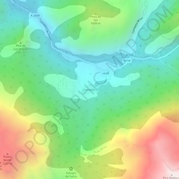
Name: Saravillo topographic map, elevation, terrain.

Location: Saravillo, Plan, Sobrarbe, Huesca, Aragon, 22366, Spain (42.53430 0.23823 42.57430 0.27823)

Average elevation: 1,416 m

Minimum elevation: 820 m

Maximum elevation: 2,593 m

Gear up for your next adventure:

🥾Hiking Boots - Sturdy boots providing ankle support and traction on rugged trails
🥾Hiking Leggings - Comfortable leggings for outdoor activities
🥾Mountain Hiking Boots - High-traction boots for rocky terrain
💡LED Headlamp - Hands-free illumination for night hiking and camping
🧣Merino Neck Gaiter - Protects against wind, sun, and cold at high altitudes

As an Amazon Associate, this site earns from qualifying purchases at no extra cost to you.