Spain topographic maps
Click on a map to view its topography, its elevation and its terrain.
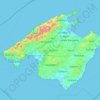
Majorca
Mallorca and the other Balearic Islands are geologically an extension of the fold mountains of the Betic Cordillera of Andalusia. They consist primarily of sediments deposited in the Tethys Sea during the Mesozoic era. These marine deposits have given rise to calcareous rocks which are often fossiliferous. The…
Average elevation: 61 m
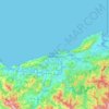
Donostia / San Sebastián
Spain > Autonomous Community of the Basque Country > Donostialdea > Donostia / San Sebastián
Average elevation: 134 m
Pancrudo
Spain > Aragon > Comunidad de Teruel
It is located at high altitude among the Sistema Ibérico mountains.
Average elevation: 1,251 m

Albacete
Albacete is located in the South-East of the Iberian Peninsula, in the plains of La Mancha (part of the Inner Plateau), at an elevation of about 686 metres (2,251 feet).
Average elevation: 786 m
Almeria
During the winter, daily maximum temperatures tend to stay around 17–18 °C (63–64 °F). At night, the minimum temperature is usually around 8–10 °C (47–50 °F). This makes Almería the city with the second warmest winters in Spain and Europe, just after Cádiz. The city only receives 26 days of…
Average elevation: 97 m

Salvacañete
The landscape of the municipality is shaped by the mountains of the Serranía de Cuenca and the Cabriel river, which runs from north to south, accompanied by numerous streams. The most prominent mountains include the Peña del Ocejón at the boundary with the province of Teruel, the Cruz de los Tres Reinos at…
Average elevation: 1,358 m

Hondarribia
Spain > Autonomous Community of the Basque Country > Bidasoa Beherea / Bajo Bidasoa
Average elevation: 37 m
Urbanització Cala Llonga
Spain > Balearic Islands > Ibiza > Santa Eulària des Riu
Average elevation: 39 m
San Isidro
Spain > Valencian Community > el Baix Segura / La Vega Baja del Segura
Average elevation: 11 m
Sabadell
Spain > Catalonia > Vallès Occidental
The city covers an area of 37.79 km2 (14.59 sq mi) and its population density is 5,337.57/km2 (13,824.2/sq mi) as of 2007. The altitude is 200 metres (660 ft).
Average elevation: 183 m

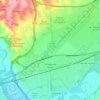
Torrejón de Ardoz
Spain > Community of Madrid > Área metropolitana de Madrid y Corredor del Henares > Torrejón de Ardoz
It is located to the east of the city of Madrid, near the A-2, the highway connecting Madrid and Barcelona. With the city located at the right-bank (north) of the Henares the relief of the municipality gently decreases in elevation from north to south.
Average elevation: 604 m

Canary Islands
The Canary Islands, especially Tenerife, Gran Canaria, Fuerteventura, and Lanzarote, are a major tourist destination, with over 12 million visitors per year. This is due to their beaches, subtropical climate, and important natural attractions, especially Maspalomas in Gran Canaria and Mount Teide (a World…
Average elevation: 13 m
Santiago de Compostela
According to medieval legend, the remains of the apostle James, son of Zebedee were brought to Galicia for burial, where they were lost. Eight hundred years later the light of a bright star guided a shepherd, Pelagius the Hermit, who was watching his flock at night to the burial site in Santiago de Compostela.…
Average elevation: 277 m
Las Vagas
Spain > Aragon > Cuencas Mineras > Martín del Río > La Rambla de Martín
Average elevation: 1,120 m
Arrutiegia
Spain > Autonomous Community of the Basque Country > Urola-Kosta > Aia
Average elevation: 223 m
Guardamar del Segura
Spain > Valencian Community > el Baix Segura / La Vega Baja del Segura
Average elevation: 9 m
El Port de la Selva
Spain > Catalonia > Upper Empordà > el Port de la Selva > El Port de la Selva
Average elevation: 76 m

Marbella
Spain > Andalusia > Costa del Sol Occidental
There are five geomorphological units: the Sierra Blanca, the Sierra Blanca piedmont (foothills), the lower hill country, the plains and the coastal dunes. The Sierra Blanca is most centrally located in the province, looming over the old village. This mountain range has three peaks: La Concha, located further…
Average elevation: 216 m

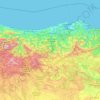
Cantabria
Towards the south are higher mountains, the tops of which form the watershed between the drainage basins of the Rivers Ebro, Duero and the rivers that flow into the Bay of Biscay. These peaks generally exceed 1,500 m (4,900 ft) from the Pass of San Glorio in the west to the Pass of Los Tornos in the eastern…
Average elevation: 609 m