Geolocate

Benifallet topographic map

Click on the map to display elevation.

About this map

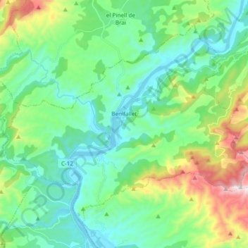
Name: Benifallet topographic map, elevation, terrain.

Location: Benifallet, Baix Ebre, Tarragona, Catalonia, 43512, Spain (40.92441 0.44467 41.01453 0.59306)

Average elevation: 230 m

Minimum elevation: 3 m

Maximum elevation: 911 m

Gear up for your next adventure:

🥾Light Hiking Boots - Lightweight and comfortable boots for day hikes
🥾Hiking Shorts - Breathable shorts suitable for summer hikes
Camping Tent - Weather-resistant tents suitable for 2 to 6 people
🧦Hiking Liner Socks - Thin base layer to prevent friction and blisters
🚲Heavy Duty Bike Lock - Secure your bike at the trailhead or during stops

As an Amazon Associate, this site earns from qualifying purchases at no extra cost to you.