Geolocate

Aspa topographic map

Click on the map to display elevation.

About this map

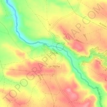
Name: Aspa topographic map, elevation, terrain.

Location: Aspa, Segrià, Lleida, Catalonia, 25151, Spain (41.49292 0.66952 41.49756 0.67528)

Average elevation: 266 m

Minimum elevation: 208 m

Maximum elevation: 305 m

Gear up for your next adventure:

🚲MTB Frame Bag - Carry tools and maps directly on your bicycle frame
🧴First Aid Kit - Essential first aid supplies for outdoor emergencies
📷Outdoor Action Camera - Capture high-elevation views and rugged adventures
🧥Waterproof Pants - Keep dry during rainy hiking conditions
🧦Crew Hiking Socks - Comfortable socks for long-distance hikes

As an Amazon Associate, this site earns from qualifying purchases at no extra cost to you.