Geolocate

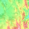
Meira topographic maps

Click on a map to view its topography, its elevation and its terrain.

Pol

Spain > Galicia > Meira

Average elevation: 589 m

Gear up for your next adventure:

🚲MTB Frame Bag - Carry tools and maps directly on your bicycle frame
🧰Emergency Multi-Tool - Compact multi-tool for outdoor survival
🕶️Polarized Sunglasses - Protect your eyes with durable polarized lenses
🧢Outdoor Cap - Protective cap for sun and rain during hikes
🥾Trail Running Boots - Durable shoes designed for trail running

As an Amazon Associate, this site earns from qualifying purchases at no extra cost to you.