Geolocate

Catarman topographic map

Click on the map to display elevation.

About this map

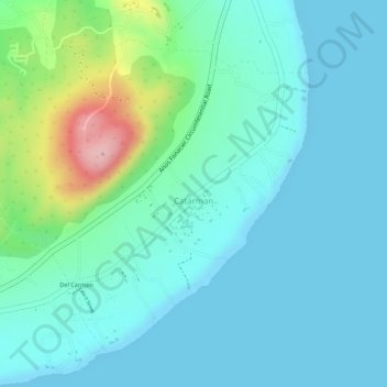
Name: Catarman topographic map, elevation, terrain.

Location: Catarman, Dauis, Bohol, Central Visayas, 6339, Philippines (9.59024 123.84680 9.61241 123.87012)

Average elevation: 39 m

Minimum elevation: 0 m

Maximum elevation: 187 m

Gear up for your next adventure:

🧊Insulated Water Bottle - Keeps drinks cold in summer and prevents freezing in winter
🦯Trekking Poles - Reduced impact on joints for steep topographic climbs
📷Outdoor Action Camera - Capture high-elevation views and rugged adventures
🧭GPS Outdoor Watch - Smart watch for navigation and fitness tracking in nature
🕶️Polarized Sunglasses - Protect your eyes with durable polarized lenses

As an Amazon Associate, this site earns from qualifying purchases at no extra cost to you.