Geolocate

Biabas topographic map

Click on the map to display elevation.

About this map

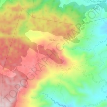
Name: Biabas topographic map, elevation, terrain.

Location: Biabas, Guindulman, Bohol, Central Visayas, Philippines (9.78206 124.38338 9.82088 124.42973)

Average elevation: 400 m

Minimum elevation: 155 m

Maximum elevation: 656 m

Gear up for your next adventure:

🚲Heavy Duty Bike Lock - Secure your bike at the trailhead or during stops
🧦Thermal Socks - Warm socks for winter hiking or camping
Bushcraft Tarp - Versatile emergency shelter or gear protection
🪜Heavy Duty Carabiners - Multi-use clips for securing gear to your backpack
🎒Backpack Rain Cover - External shield to keep your entire pack dry

As an Amazon Associate, this site earns from qualifying purchases at no extra cost to you.