Geolocate

Treviglio topographic map

Click on the map to display elevation.

About this map

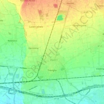
Name: Treviglio topographic map, elevation, terrain.

Location: Treviglio, Bergamo, Lombardy, 24047, Italy (45.49872 9.54715 45.56955 9.63457)

Average elevation: 130 m

Minimum elevation: 109 m

Maximum elevation: 159 m

Gear up for your next adventure:

Lightweight Camping Tent - Portable shelter optimized for Canadian backcountry camping
🧢Sun Protection Cap - Breathable cap to protect from sun exposure
🧥Fleece Jacket - Warm and lightweight jacket for layering
Camping Coffee Maker - Brew fresh coffee anywhere on the topographic map
🥾Trekking Boots - Durable boots for long-distance trekking

As an Amazon Associate, this site earns from qualifying purchases at no extra cost to you.