Geolocate

Valpiana topographic map

Click on the map to display elevation.

About this map

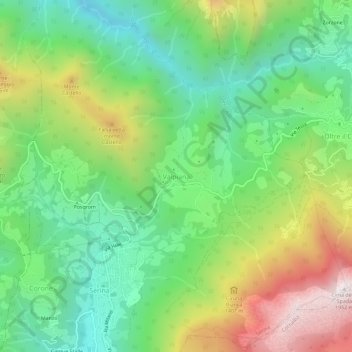
Name: Valpiana topographic map, elevation, terrain.

Location: Valpiana, Serina, Comunità Montana della Valle Brembana, Bergamo, Lombardy, 24017, Italy (45.86489 9.72192 45.90489 9.76192)

Average elevation: 1,106 m

Minimum elevation: 635 m

Maximum elevation: 1,920 m

Other topographic maps

Click on a map to view its topography, its elevation and its terrain.

Adrara San Martino

Italy > Lombardy > Bergamo

Average elevation: 678 m

Bergamo

Italy > Lombardy > Bergamo

Average elevation: 269 m

Gorno

Italy > Lombardy > Bergamo

The municipality is located in the lower part of the Val del Riso, a valley that starts east of the Colle di Zambla and descends opening westward, flowing into the wider Val Seriana. The territory draws an irregular geometric profile, with very pronounced elevation variations. The altitude of the municipal…

Average elevation: 968 m

Dalmine

Italy > Lombardy > Bergamo

Average elevation: 201 m

Gear up for your next adventure:

🦌Outdoor Trail Camera - Monitor wildlife activity near your favorite spots
🧰Emergency Multi-Tool - Compact multi-tool for outdoor survival
🗺️Topographic Maps - Detailed maps to explore trails, mountains, and wilderness areas
🔨Vehicle Emergency Tool - Safety tool for remote road trips to trailheads
🛁Quick-Dry Microfiber Towel - Space-saving towel that dries rapidly on the move

As an Amazon Associate, this site earns from qualifying purchases at no extra cost to you.