Geolocate

Amora topographic map

Click on the map to display elevation.

About this map

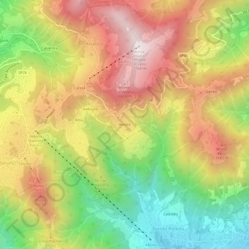
Name: Amora topographic map, elevation, terrain.

Location: Amora, Aviatico, Bergamo, Lombardia, 24020, Italia (45.76732 9.75867 45.80732 9.79867)

Average elevation: 861 m

Minimum elevation: 362 m

Maximum elevation: 1,350 m

Gear up for your next adventure:

Camping Tent - Weather-resistant tents suitable for 2 to 6 people
🦶Anti-Blister Balm - Prevents friction and hotspots during long ascents
🧢Beanie Hat - Keep your head warm in cold weather
🧴Waterproofing Spray - Restore the DWR coating on jackets and tents
🧭GPS Handheld Device - Reliable GPS navigation for outdoor adventures

As an Amazon Associate, this site earns from qualifying purchases at no extra cost to you.