Geolocate

Villassio topographic map

Click on the map to display elevation.

About this map

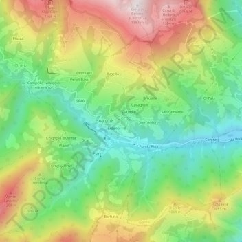
Name: Villassio topographic map, elevation, terrain.

Location: Villassio, Gorno, Bergamo, Lombardia, 24020, Italia (45.84231 9.82266 45.88231 9.86266)

Average elevation: 843 m

Minimum elevation: 473 m

Maximum elevation: 1,362 m

Gear up for your next adventure:

🧤Thermal Hiking Gloves - Grip-enhanced gloves for cold-weather altitude trekking
🛁Quick-Dry Microfiber Towel - Space-saving towel that dries rapidly on the move
🔋Emergency Crank Radio - Weather alerts and power without needing batteries
🥾Waterproof Hiking Boots - Boots keeping your feet dry in wet conditions
🪑Ultralight Camping Stool - Compact seating for rest stops during long hikes

As an Amazon Associate, this site earns from qualifying purchases at no extra cost to you.