
Thank you for supporting this site ❤️
Make a donation
Make a donation
Gear up for your next adventure:
As an Amazon Associate, this site earns from qualifying purchases at no extra cost to you.
Bondione topographic map
Click on the map to display elevation.
Thank you for supporting this site ❤️
Make a donation
Make a donation
Gear up for your next adventure:
As an Amazon Associate, this site earns from qualifying purchases at no extra cost to you.
About this map
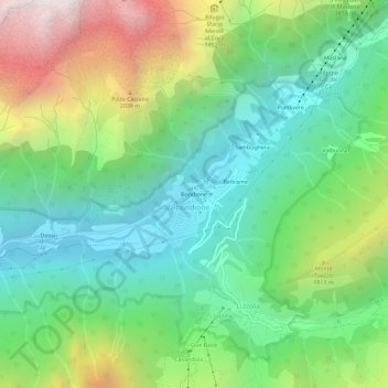
Name: Bondione topographic map, elevation, terrain.
Location: Bondione, Lizzola, Valbondione, Bergamo, Lombardy, Italy (46.01553 9.98681 46.05553 10.02681)
Average elevation: 1,457 m
Minimum elevation: 831 m
Maximum elevation: 2,711 m
Thank you for supporting this site ❤️
Make a donation
Make a donation
Gear up for your next adventure:
As an Amazon Associate, this site earns from qualifying purchases at no extra cost to you.