Geolocate

Fiobbio topographic map

Click on the map to display elevation.

About this map

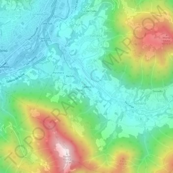
Name: Fiobbio topographic map, elevation, terrain.

Location: Fiobbio, Vall'Alta, Albino, Bergamo, Lombardia, 24021, Italia (45.73226 9.80512 45.77226 9.84512)

Average elevation: 581 m

Minimum elevation: 324 m

Maximum elevation: 1,145 m

Gear up for your next adventure:

🎒Hiking Daypack - Lightweight and durable backpacks for day trips and excursions
🥾Lightweight Hiking Boots - Boots for comfort and mobility on long hikes
🧭Orienteering Kit - Tools for map reading and navigation in the wild
Bushcraft Tarp - Versatile emergency shelter or gear protection
🔥Emergency Fire Starter - Reliable ignition source for all weather conditions

As an Amazon Associate, this site earns from qualifying purchases at no extra cost to you.