
Aguas Calientes topographic map
Click on the map to display elevation.
About this map
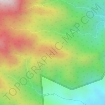
Name: Aguas Calientes topographic map, elevation, terrain.
Average elevation: 623 m
Minimum elevation: 290 m
Maximum elevation: 1,017 m
Other topographic maps
Click on a map to view its topography, its elevation and its terrain.
Jinotega
The city of Jinotega "Las Brumas" is the departmental capital of the homonymous department with an urban population of 53 265 inhabitants in the year 2017. It is located in a valley at an altitude of 1,003.87 meters above sea level with a cool climate at an average temperature of 25 °C and a distance of 142…
Average elevation: 466 m
Managua
Managua's city area extends about 544 square kilometers (210 square miles), essentially south from the south shore of Lake Managua. The lakeshore is at an altitude of 55 meters (180 feet) above sea level, and the city climbs as it gets towards the Sierras de Managua further south where it is over 700 meters…
Average elevation: 223 m
Lake Nicaragua
Lake Nicaragua or Cocibolca or Granada (Spanish: Lago de Nicaragua, Lago Cocibolca, Mar Dulce, Gran Lago, Gran Lago Dulce, or Lago de Granada) is a freshwater lake in Nicaragua. Of tectonic origin and with an area of 8,264 km2 (3,191 sq mi), it is the largest lake in Central America, the 19th largest lake in…
Average elevation: 88 m
Estelí
Estelí is on the Pan-American Highway, 150 km north of Managua. It enjoys a temperate climate most of the year due to its location in the north central highlands at a mean elevation of 844 m (2769 ft) above sea level. The city is also surrounded by forested mountains of pines, oaks, and walnuts, and plateaus…
Average elevation: 958 m
Managua
Managua's city area extends about 544 square kilometers (210 square miles), essentially south from the south shore of Lake Managua. The lakeshore is at an altitude of 55 meters (180 feet) above sea level, and the city climbs as it gets towards the Sierras de Managua further south where it is over 700 meters…
Average elevation: 223 m
Condega (Municipio)
Condega (Spanish pronunciation: [konˈdeɣa]) is a municipality in the Estelí department of Nicaragua. It was officially incorporated on June 9, 1962. Condega is situated on the Pan-American Highway (Route One) at a distance of 185 kilometers north of Managua, and at an altitude of 560 meters (1,837 feet)…
Average elevation: 836 m
Esteli
Located on the Pan-American Highway, 150 km north of Managua, Estelí is a fast-growing and progressive city. It enjoys a pleasant climate most of the year due to its location in the north central highlands at a mean elevation of 844 m (2769 ft) above sea level. The city is also surrounded by forested…
Average elevation: 958 m
Masatepe (Municipio)
Masatepe is located on top of the Plateau of towns, at an altitude of 475m, the total area can be divided into two main different types of biomes.
Average elevation: 426 m
El Ayote
The rainy season is hot, oppressive, and cloudy, and the dry season is very hot, muggy, windy, and partly cloudy. Over the course of the year, the temperature generally varies from 18 to 32 °C and rarely falls below 16 °C or rises above 34 °C. The municipality's topography is formed by natural accidents…
Average elevation: 192 m
Jinotega
The city of Jinotega "Las Brumas" is the departmental capital of the homonymous department with an urban population of 53 265 inhabitants in the year 2017. It is located in a valley at an altitude of 1,003.87 meters above sea level with a cool climate at an average temperature of 25 °C and a distance of 142…
Average elevation: 466 m
Ocotal
Characterised by steep hills in the north and south, plateaus in the west and a valley in the center. It lies at an altitude of 500 metres (1,640 feet) above sea level.
Average elevation: 756 m