
Condega (Municipio) topographic map
Click on the map to display elevation.
Condega (Municipio)
Condega (Spanish pronunciation: [konˈdeɣa]) is a municipality in the Estelí department of Nicaragua. It was officially incorporated on June 9, 1962. Condega is situated on the Pan-American Highway (Route One) at a distance of 185 kilometers north of Managua, and at an altitude of 560 meters (1,837 feet) above sea level.
About this map
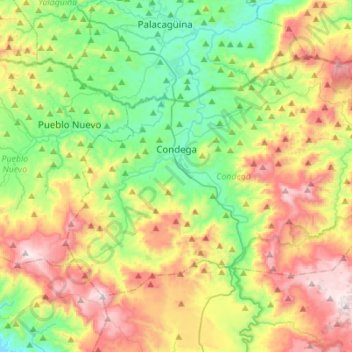
Name: Condega (Municipio) topographic map, elevation, terrain.
Location: Condega (Municipio), Estelí, 32100, Nicaragua (13.24897 -86.48408 13.43236 -86.20814)
Average elevation: 836 m
Minimum elevation: 448 m
Maximum elevation: 1,458 m
Other topographic maps
Click on a map to view its topography, its elevation and its terrain.