Geolocate

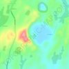
Las Cruces topographic map

Click on the map to display elevation.

About this map

Name: Las Cruces topographic map, elevation, terrain.

Location: Las Cruces, El Sauce, León, 22800, Nicaragua (12.90334 -86.46065 12.90635 -86.45778)

Average elevation: 786 m

Minimum elevation: 508 m

Maximum elevation: 1,072 m

Other topographic maps

Click on a map to view its topography, its elevation and its terrain.

Punta de Cerro

Nicaragua > Leon

Average elevation: 214 m

Laguna Seca

Nicaragua > Leon

Average elevation: 120 m

Telica volcano

Nicaragua > Leon > Telica

Telica became active in August 1999. An eruption produced ash-fall, and on 18 August a lava lake was observed in the summit crater. The ash eruptions continued until February 2000 and declined afterwards. From 9 January to February 2007, small ash eruptions produced ash clouds reaching altitudes of 4900 ft…

Average elevation: 658 m
Mira Lago

Nicaragua > Leon > La Paz Centro > El Mojón

Average elevation: 58 m

Laguna Seca

Nicaragua > Leon > La Paz Centro

Average elevation: 120 m

Cerro Negro

Nicaragua > Leon > Larreynaga (Municipio)

Average elevation: 473 m

Laguna Seca

Nicaragua > Leon

Average elevation: 120 m

Gear up for your next adventure:

🛌Down Sleeping Bag - Superior warmth-to-weight ratio for cold nights
🧣Merino Neck Gaiter - Protects against wind, sun, and cold at high altitudes
🧢Beanie Hat - Keep your head warm in cold weather
🛶Canoe Life Vest - Safety vest for water sports
⛺Tent Footprint - Protect tent floor and increase durability

As an Amazon Associate, this site earns from qualifying purchases at no extra cost to you.