Geolocate

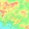
Chontales topographic maps

Click on a map to view its topography, its elevation and its terrain.

El Coral

Nicaragua > Chontales

The topography is predominantly flat, with a few small peaks along the northern border. The highest peak is the Cerro Las Paces at 545 m (1,788 ft). There are several rivers flowing through the municipality, the major of which is the El Rama River. The vegetation consists of tropical rainforests with a high…

Average elevation: 175 m

Juigalpa

Nicaragua > Chontales

Juigalpa sits within a valley in the Amerrisque Mountains. The Carretera passes through the lowest parts of the city with the elevation rising on both sides. Higher points throughout the city provide clear views of the Amerrisque mountains.

Average elevation: 103 m

Santo Tomás

Nicaragua > Chontales

Average elevation: 330 m

Acoyapa

Nicaragua > Chontales

Average elevation: 96 m

Ensenada Las Britas

Nicaragua > Chontales

Average elevation: 32 m

Caño Los Lagartos

Nicaragua > Chontales > Acoyapa

Average elevation: 83 m

About this place

Gear up for your next adventure:

🧰Emergency Multi-Tool - Compact multi-tool for outdoor survival
🔦LED Headlamp - Hands-free lighting for early morning starts or late finishes
🧢Hiking Hat - Sun-protective and breathable hats for long treks
🧶550 Survival Paracord - Versatile utility cord for emergency repairs and rigging
🔭Compact Monocular - One-handed bird watching and trail spotting

As an Amazon Associate, this site earns from qualifying purchases at no extra cost to you.