
Catarina topographic map
Click on the map to display elevation.
About this map
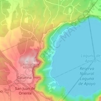
Name: Catarina topographic map, elevation, terrain.
Location: Catarina, Masaya, 42500, Nicaragua (11.90637 -86.09289 11.95051 -86.03088)
Average elevation: 333 m
Minimum elevation: 69 m
Maximum elevation: 606 m
Other topographic maps
Click on a map to view its topography, its elevation and its terrain.
Volcán Masaya
In 1979, Masaya became Nicaragua's first national park, named Masaya Volcano National Park (Parque Nacional Volcán Masaya). The park has an area of 54 km2 (21 sq mi) and includes two volcanoes and five craters, as well as a range of elevations between 100 and 630 meters above sea level. In the park is a lava…
Average elevation: 449 m