Geolocate

Distrito III topographic map

Click on the map to display elevation.

About this map

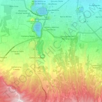
Name: Distrito III topographic map, elevation, terrain.

Location: Distrito III, Managua, Nicaragua (12.03751 -86.39185 12.14714 -86.27465)

Average elevation: 308 m

Minimum elevation: 43 m

Maximum elevation: 722 m

Other topographic maps

Click on a map to view its topography, its elevation and its terrain.

Laguna de Tiscapa

Nicaragua > Managua > Managua

Average elevation: 90 m

Gear up for your next adventure:

🥾Trail Running Boots - Durable shoes designed for trail running
🧴Waterproofing Spray - Restore the DWR coating on jackets and tents
🥾All-Terrain Hiking Boots - Versatile boots for varied hiking conditions
Backpacking Tent - Lightweight tent for long-distance hiking trips
🥤Collapsible Travel Cup - Saves space and weight in your mess kit

As an Amazon Associate, this site earns from qualifying purchases at no extra cost to you.