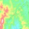
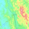
Hseni Township topographic map
Click on the map to display elevation.
About this map

Name: Hseni Township topographic map, elevation, terrain.
Location: Hseni Township, Shan State, Special Region 1, Myanmar (23.11365 97.65235 23.40148 98.59974)
Average elevation: 1,092 m
Minimum elevation: 389 m
Maximum elevation: 2,313 m
Other topographic maps
Click on a map to view its topography, its elevation and its terrain.


Pu Long (Lar Hu)
Myanmar > Shan State > Kengtung District > Mong Ping Township
Average elevation: 1,056 m


Taunggyi
Myanmar > Shan State > Taunggyi District
Taunggyi is the capital and largest city of Shan State, Myanmar. It also serves as the administrative seat of Southern Shan State. Situated on the eastern mountains of Myanmar at an elevation of 4,712 feet (1,436 meters) above sea level, it is a city known for its pleasant and cool climate. Unlike many other…
Average elevation: 1,151 m


Taunggyi
Myanmar > Shan State > Taunggyi District
Taunggyi (Burmese: တောင်ကြီးမြို့; MLCTS: taung kri: mrui. [tàʊɰ̃dʑí mjo̰]; Shan: ဝဵင်းတူၼ်ႈတီး Shan pronunciation: [weŋ˥ ton˧˧˨ ti˥]) is the capital and largest city of Shan State, Myanmar (Burma) and lies on the Thazi-Kyaingtong road at an…
Average elevation: 1,151 m

Kengtung
Myanmar > Shan State > Kengtung District > Kengtung Township > Kengtung
Average elevation: 824 m
Taunggyi
Myanmar > Shan State > Taunggyi District
Taunggyi (Burmese: တောင်ကြီးမြို့, MLCTS: taung kri: mrui. [tàʊɰ̃dʑí mjo̰]) is the capital and largest city of Shan State, Myanmar (Burma); and lies on the Thazi-Kyaingtong road at an elevation of 4,712 feet (1,436 m), just north of Shwenyaung and Inle Lake within the Myelat…
Average elevation: 1,151 m
Kalaw
Myanmar > Shan State > Kalaw Township
The hill station is located at an elevation of 1310 metres, 50 km from the Inle lake. Kalaw is famous for hiking and trekking. Many trekking trails ranging from nearby places to Inle Lake and Pindaya. The town still feels like a high-altitude holiday resort – the air is cool, the atmosphere is calm and the…
Average elevation: 1,348 m


Kalaw
Myanmar > Shan State > Kalaw District
The hill station is located at an elevation of 1310 metres, 50 km from the Inle lake. Kalaw is famous for hiking and trekking. Many trekking trails ranging from nearby places to Inle Lake and Pindaya. The town still feels like a high-altitude holiday resort – the air is cool, the atmosphere is calm and the…
Average elevation: 1,366 m

Kalaw
Myanmar > Shan State > Kalaw District
The hill station is located at an elevation of 1310 metres, 50 km from the Inle lake. Kalaw is famous for hiking and trekking. Many trekking trails ranging from nearby places to Inle Lake and Pindaya. The town still feels like a high-altitude holiday resort – the air is cool, the atmosphere is calm and the…
Average elevation: 1,366 m
Taunggyi
Myanmar > Shan State > Taunggyi District
Taunggyi (Burmese: တောင်ကြီးမြို့; MLCTS: taung kri: mrui. [tàʊɰ̃dʑí mjo̰]; Shan: ဝဵင်းတူၼ်ႈတီး ဝဵင်းလူင်တႆးႁဝ်း Shan pronunciation: [weŋ˥ ton˧˧˨ ti˥]; Pa'O language : ဝေင်ꩻတောင်ႏကီꩻ…
Average elevation: 1,151 m
Taunggyi
Myanmar > Shan State > Taunggyi District
Taunggyi (Burmese: တောင်ကြီးမြို့, MLCTS: taung kri: mrui. [tàʊɰ̃dʑí mjo̰]) is the capital and largest city of Shan State, Myanmar (Burma); and lies on the Thazi-Kyaingtong road at an elevation of 4,712 feet (1,436 m), just north of Shwenyaung and Inle Lake within the Myelat…
Average elevation: 1,151 m




Hseni
Myanmar > Shan State > Hsenwi District
The southern portion has much more flat land, along the, line of the Nam Tu, its tributaries the Nam Yao and the Nam Nim, and the Nam Yek flowing into the Salween. This was formerly densely populated, and still remains the most valuable portion of the state. A range running westwards from the Salween, and…
Average elevation: 734 m


Kalaw
Myanmar > Shan State > Kalaw District
The hill station is located at an elevation of 1310 metres, 50 km from the Inle lake. Kalaw is famous for hiking and trekking. Many trekking trails ranging from nearby places to Inle Lake and Pindaya. The town still feels like a high-altitude holiday resort – the air is cool, the atmosphere is calm and the…
Average elevation: 1,366 m