Geolocate

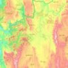
Nang Ku topographic map

Click on the map to display elevation.

About this map

Name: Nang Ku topographic map, elevation, terrain.

Location: Nang Ku, Lawksawk Township, Taunggyi District, Shan State, Myanmar (21.63395 96.90843 21.67395 96.94843)

Average elevation: 748 m

Minimum elevation: 688 m

Maximum elevation: 889 m

Other topographic maps

Click on a map to view its topography, its elevation and its terrain.
Pinlaung Township

Myanmar > Shan State > Taunggyi District > Pinlaung Township

Pinlaung Township accounts for the largest area of tea cultivation in southern Shan State. The Tea grown here is of the Assamica cultivar. Tea plantations in the area cover 12,000 acres, with half of the cultivation taking place in the higher elevations of Le Hlaung, 10 miles from Pinlaung. In the Koe Khaung…

Average elevation: 964 m

Pindaya Township

Myanmar > Shan State > Taunggyi District

Average elevation: 1,194 m

Hopong Township

Myanmar > Shan State > Taunggyi District

Average elevation: 1,177 m

Pekon Township

Myanmar > Shan State > Taunggyi District

Average elevation: 990 m

Yay Byū

Myanmar > Shan State > Taunggyi District

Average elevation: 1,473 m

Gear up for your next adventure:

🧥Thermal Layer - Insulating layer for cold outdoor conditions
🧤Rechargeable Heated Gloves - Extreme warmth for Canadian winter expeditions
🎒Backpack Rain Cover - External shield to keep your entire pack dry
🔭Compact Monocular - One-handed bird watching and trail spotting
🔦LED Flashlight - Powerful and long-lasting flashlight for camping and emergencies

As an Amazon Associate, this site earns from qualifying purchases at no extra cost to you.