Geolocate

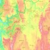
Pu Chei (Lower) topographic map

Click on the map to display elevation.

About this map

Name: Pu Chei (Lower) topographic map, elevation, terrain.

Location: Pu Chei (Lower), Pekon Township, Taunggyi District, Shan State, Myanmar (19.87051 96.95733 19.91051 96.99733)

Average elevation: 926 m

Minimum elevation: 879 m

Maximum elevation: 1,133 m

Other topographic maps

Click on a map to view its topography, its elevation and its terrain.
Pinlaung Township

Myanmar > Shan State > Taunggyi District > Pinlaung Township

Pinlaung Township accounts for the largest area of tea cultivation in southern Shan State. The Tea grown here is of the Assamica cultivar. Tea plantations in the area cover 12,000 acres, with half of the cultivation taking place in the higher elevations of Le Hlaung, 10 miles from Pinlaung. In the Koe Khaung…

Average elevation: 964 m

Pindaya Township

Myanmar > Shan State > Taunggyi District

Average elevation: 1,194 m

Hopong Township

Myanmar > Shan State > Taunggyi District

Average elevation: 1,177 m

Pekon Township

Myanmar > Shan State > Taunggyi District

Average elevation: 990 m

Yay Byū

Myanmar > Shan State > Taunggyi District

Average elevation: 1,473 m

Gear up for your next adventure:

🧭GPS Outdoor Watch - Smart watch for navigation and fitness tracking in nature
🥾Mountaineering Boots - Supportive boots for climbing and high-altitude hiking
🔋Emergency Crank Radio - Weather alerts and power without needing batteries
🛶Kayak Dry Bag - Waterproof storage for kayaking adventures
🥫Freeze-Dried Meals - Lightweight, high-calorie nutrition for multi-day treks

As an Amazon Associate, this site earns from qualifying purchases at no extra cost to you.