Geolocate

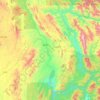
Nansang topographic map

Click on the map to display elevation.

About this map

Name: Nansang topographic map, elevation, terrain.

Location: Nansang, Nansang Township, Namsang District, Shan State, 06161, Myanmar (20.72941 97.56185 21.04941 97.88185)

Average elevation: 1,058 m

Minimum elevation: 858 m

Maximum elevation: 1,744 m

Other topographic maps

Click on a map to view its topography, its elevation and its terrain.
Kunhing Township

Myanmar > Shan State > Namsang District

Average elevation: 799 m

Gear up for your next adventure:

📷Outdoor Action Camera - Capture high-elevation views and rugged adventures
🥽Outdoor Goggles - Protective eyewear for outdoor activities
🥾Trail Running Shoes - Lightweight and durable shoes for trail running
🛁Quick-Dry Microfiber Towel - Space-saving towel that dries rapidly on the move
🧴Waterproofing Spray - Restore the DWR coating on jackets and tents

As an Amazon Associate, this site earns from qualifying purchases at no extra cost to you.