Geolocate

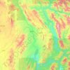
Kone Yaw topographic map

Click on the map to display elevation.

About this map

Name: Kone Yaw topographic map, elevation, terrain.

Location: Kone Yaw, Loilem Township, Loilen District, Shan State, Myanmar (20.70758 97.48151 20.74758 97.52151)

Average elevation: 1,586 m

Minimum elevation: 1,261 m

Maximum elevation: 1,913 m

Other topographic maps

Click on a map to view its topography, its elevation and its terrain.

Hwayhin

Myanmar > Shan State > Loilen District

Average elevation: 1,555 m

Loilem Township

Myanmar > Shan State > Loilen District

Average elevation: 1,196 m

Kunhing Township

Myanmar > Shan State > Loilen District

Average elevation: 799 m

Loilem Township

Myanmar > Shan State > Loilen District

Average elevation: 1,172 m

Gear up for your next adventure:

🚲MTB Frame Bag - Carry tools and maps directly on your bicycle frame
🐕Hiking Dog Pack - Let your canine companion carry their own water and food
⛺Backpacking Tent - Lightweight tent for long-distance hiking trips
🛰️Satellite Messenger - Emergency communication for areas with no cell service
🎒Hiking Backpack - Lightweight and ergonomic backpacks for day hikes or multi-day treks

As an Amazon Associate, this site earns from qualifying purchases at no extra cost to you.