Geolocate

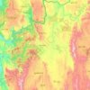
Pinlaung topographic map

Click on the map to display elevation.

About this map

Name: Pinlaung topographic map, elevation, terrain.

Location: Pinlaung, Pinlaung Township, Taunggyi District, Shan State, Myanmar (20.08300 96.74214 20.16300 96.82214)

Average elevation: 1,534 m

Minimum elevation: 1,379 m

Maximum elevation: 1,862 m

Other topographic maps

Click on a map to view its topography, its elevation and its terrain.
Pinlaung Township

Myanmar > Shan State > Taunggyi District > Pinlaung Township

Pinlaung Township accounts for the largest area of tea cultivation in southern Shan State. The Tea grown here is of the Assamica cultivar. Tea plantations in the area cover 12,000 acres, with half of the cultivation taking place in the higher elevations of Le Hlaung, 10 miles from Pinlaung. In the Koe Khaung…

Average elevation: 964 m

Pindaya Township

Myanmar > Shan State > Taunggyi District

Average elevation: 1,194 m

Hopong Township

Myanmar > Shan State > Taunggyi District

Average elevation: 1,177 m

Pekon Township

Myanmar > Shan State > Taunggyi District

Average elevation: 990 m

Yay Byū

Myanmar > Shan State > Taunggyi District

Average elevation: 1,473 m

Gear up for your next adventure:

🥾Waterproof Trail Shoes - Shoes designed to handle wet terrain
🧢Outdoor Visor - Breathable visor for sunny hikes
🥾Trail Hiking Socks - Comfortable socks to prevent blisters and fatigue
🪑Ultralight Camping Stool - Compact seating for rest stops during long hikes
🕶️Polarized Sunglasses - Protect your eyes with durable polarized lenses

As an Amazon Associate, this site earns from qualifying purchases at no extra cost to you.