

Hamburg topographic map
Click on the map to display elevation.
Hamburg
The neighborhoods of Neuenfelde, Cranz, Francop and Finkenwerder are part of the Altes Land (old land) region, the largest contiguous fruit-producing region in Central Europe. Neugraben-Fischbek has Hamburg's highest elevation, the Hasselbrack at 116.2 metres (381 ft) AMSL. Hamburg borders the states of Schleswig-Holstein and Lower Saxony.
About this map
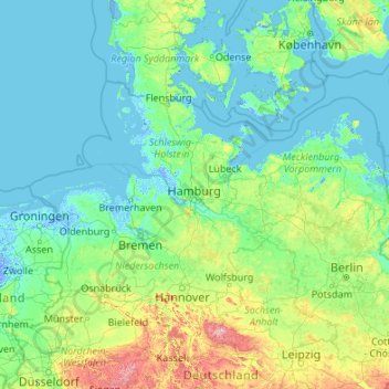
Name: Hamburg topographic map, elevation, terrain.
Location: Hamburg, Germany (50.94376 7.40991 56.14376 12.60991)
Average elevation: 56 m
Minimum elevation: -5 m
Maximum elevation: 999 m
Other topographic maps
Click on a map to view its topography, its elevation and its terrain.
Berlin
Berlin straddles the banks of the Spree, which flows into the Havel (a tributary of the Elbe) in the western borough of Spandau. Among the city's main topographical features are the many lakes in the western and southeastern boroughs formed by the Spree, Havel and Dahme, the largest of which is Lake…
Average elevation: 48 m
Harz
The Harz (German: [haːɐ̯ts] (listen)) is a highland area in northern Germany. It has the highest elevations for that region, and its rugged terrain extends across parts of Lower Saxony, Saxony-Anhalt, and Thuringia. The name Harz derives from the Middle High German word Hardt or Hart (hill forest). The name…
Average elevation: 280 m

Stuttgart
The core area of Stuttgart lies in the 48° fertile bowl angle about 900 ft (270 m) above sea level, an hour from the Black Forest and Swabian Jura on the banks of the Neckar river at 48°47′N 9°11′E / 48.783°N 9.183°E / 48.783; 9.183 115 mi (185 km) to the west and north of Munich. The city is…
Average elevation: 351 m
Munich
Munich lies on the elevated plains of Upper Bavaria, about 50 km (31 mi) north of the northern edge of the Alps, at an altitude of about 520 m (1,706 ft) ASL. The local rivers are the Isar and the Würm. Munich is situated in the Northern Alpine Foreland. The northern part of this sandy plateau includes a…
Average elevation: 524 m
Berlin
Berlin straddles the banks of the Spree, which flows into the Havel (a tributary of the Elbe) in the western borough of Spandau. Among the city's main topographical features are the many lakes in the western and southeastern boroughs formed by the Spree, Havel and Dahme, the largest of which is Lake…
Average elevation: 48 m


Baden-Württemberg
The climate across the states varies. This is mostly due to a high amount of mountains and highlands inside of the state. Most parts in the western parts (Baden) lower than 500–800 metres (1,600–2,600 ft) enjoy an almost year round mild oceanic climate (cfb in Köppen classification). The climate in the…
Average elevation: 442 m
Nürburg
Germany > Rhineland-Palatinate > Landkreis Ahrweiler
Nürburg has a semi-continental climate with both oceanic and continental tendencies. It does however land in the former category (Köppen Cfb). With regards to the racetrack, due to the Nordschleife's varied terrain and elevation, weather may be completely different on either end of the track. The elevation…
Average elevation: 560 m
Black Forest
Its highest peak is the Feldberg with an elevation of 1,493 metres (4,898 ft) above sea level. Roughly oblong in shape, with a length of 160 kilometres (100 miles) and breadth of up to 50 km (30 mi), it has an area of about 6,009 km2 (2,320 sq mi).
Average elevation: 471 m


Brakel
Germany > North Rhine-Westphalia > Kreis Höxter
Brakel's Hanseatic roots go back to its early history and stretch through the Middle Ages. From the first written reference to "villa brechal" in 836 (in connection with transferring Saint Vitus's bones from Saint Denis, France, to Corvey) through to the 12th century, when it was the seat of the Lords of…
Average elevation: 232 m

Aachen
Germany > North Rhine-Westphalia > Aachen (district)
The maximum dimensions of the city's territory are 21.6 km (13+3⁄8 mi) from north to south, and 17.2 km (10+3⁄4 mi) from east to west. The city limits are 87.7 km (54+1⁄2 mi) long, of which 23.8 km (14+3⁄4 mi) border Belgium and 21.8 km (13+1⁄2 mi) the Netherlands. The highest point in Aachen,…
Average elevation: 225 m
Garmisch-Partenkirchen
Germany > Bavaria > Landkreis Garmisch-Partenkirchen
Garmisch-Partenkirchen leans towards an oceanic climate, and its winters are colder than the rest of Bavaria. Due to its higher elevation, it is very close to the winters associated with continental climates; it has a relatively wet and snowy climate, with high precipitation year-round.
Average elevation: 1,326 m
Munich
Munich lies on the elevated plains of Upper Bavaria, about 50 km (31 mi) north of the northern edge of the Alps, at an altitude of about 520 m (1,706 ft) ASL. The local rivers are the Isar and the Würm. Munich is situated in the Northern Alpine Foreland. The northern part of this sandy plateau includes a…
Average elevation: 524 m
Bisingen
Germany > Baden-Württemberg > Zollernalbkreis
Bisingen is physically located along the northern edge of the Swabian Jura, between the Hundsrücken and the Hohenzollern mountains. Elevation above sea level in the municipal area ranges from a low of 485 meters (1,591 ft) Normalnull (NN) on the Klingenbach to a high of 912 meters (2,992 ft) NN at the top of…
Average elevation: 603 m
Monschau
Germany > North Rhine-Westphalia > Aachen (district)
At two meetings in the spring meet canoeists for about 50 years in Monschau international events, and a whitewater races. Nationally known is the Monschau Marathon more than 760 meters of altitude, which takes place in August.
Average elevation: 551 m
Nuremberg
Nuremberg has an oceanic climate (Köppen Cfb) with a certain humid continental influence (Dfb), categorized in the latter by the 0 °C isotherm. The city's climate is influenced by its inland position and higher altitude. Winters are changeable, with either mild or cold weather: the average temperature is…
Average elevation: 336 m

Danger of ground subsidence!
Germany > Brandenburg > Dahme-Spreewald > Luckau > Fürstlich Drehna
Average elevation: 78 m
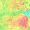


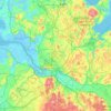
Hamburg
The neighborhoods of Neuenfelde, Cranz, Francop and Finkenwerder are part of the Altes Land (old land) region, the largest contiguous fruit-producing region in Central Europe. Neugraben-Fischbek has Hamburg's highest elevation, the Hasselbrack at 116.2 metres (381 ft) AMSL. Hamburg borders the states of…
Average elevation: 27 m
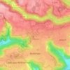
Mutlangen
Germany > Baden-Württemberg > Ostalbkreis
Mutlangen is located between the Welzheim Forest and the Swabian Keuper-Lias Plains on an elevation above the Rems valley. The neighboring communes of Mutlangen are Durlangen in the north, the city of Schwäbisch Gmünd in the east and south as well as Alfdorf in the west. Mutlangen consists of the small town…
Average elevation: 448 m

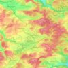
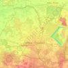
Garmisch-Partenkirchen
Germany > Bavaria > Landkreis Garmisch-Partenkirchen
Garmisch-Partenkirchen leans towards an oceanic climate, and its winters are colder than the rest of Bavaria. Due to its higher elevation, it is very close to the winters associated with continental climates; it has a relatively wet and snowy climate, with high precipitation year-round. As of 2013, the regions…
Average elevation: 1,326 m
Neuschwanstein Castle
Germany > Bavaria > Landkreis Ostallgäu > Hohenschwangau
The municipality of Schwangau lies at an elevation of 800 m (2,620 ft) at the southwest border of the German state of Bavaria. Its surroundings are characterised by the transition between the Alpine foothills in the south (toward the nearby Austrian border) and a hilly landscape in the north that appears flat…
Average elevation: 982 m
Stuttgart
The core area of Stuttgart lies in the 48° fertile bowl angle about 900 ft (270 m) above sea level, an hour from the Black Forest and Swabian Jura on the banks of the Neckar river at 48°47′N 9°11′E / 48.783°N 9.183°E / 48.783; 9.183 115 mi (185 km) to the west and north of Munich. The city is…
Average elevation: 351 m

Emmendingen
Germany > Baden-Württemberg > Landkreis Emmendingen
The Coat of arms of the city of Emmendingen depicts a red bend in a gold escutcheon (which is the old coat of arms for Baden), an armoured knight on a blue background with a silver rod in his right hand and his left hand on a silver sword hanging around his waist. The city flag is blue, yellow, and red. The…
Average elevation: 248 m








Grafenwoehr Training Area
Germany > Bavaria > Landkreis Neustadt an der Waldnaab > Grafenwöhr
Average elevation: 458 m
Mainz
Germany > Rhineland-Palatinate
Nevertheless, the post-war reconstruction took place very slowly. While cities such as Frankfurt had been rebuilt fast by a central authority, only individual efforts were initially successful in rebuilding Mainz. The reason for this was that the French wanted Mainz to expand and become a model city. Mainz lay…
Average elevation: 132 m


Stuttgart
The core area of Stuttgart lies in the 48° fertile bowl angle about 900 ft (270 m) above sea level, an hour from the Black Forest and Swabian Jura on the banks of the Neckar river at 48°47′N 9°11′E / 48.783°N 9.183°E / 48.783; 9.183 115 mi (185 km) to the west and north of Munich. The city is…
Average elevation: 351 m


Hanover
Germany > Lower Saxony > Region Hannover
In 1636 George, Duke of Brunswick-Lüneburg, ruler of the Brunswick-Lüneburg principality of Calenberg, moved his residence to Hanover. The Dukes of Brunswick-Lüneburg were elevated by the Holy Roman Emperor to the rank of Prince-Elector in 1692 and this elevation was confirmed by the Imperial Diet in 1708.…
Average elevation: 61 m



Linderhof Palace
Germany > Bavaria > Landkreis Garmisch-Partenkirchen > Ettaler Forst
Average elevation: 1,109 m


Hesse
Oculus Optikgeräte manufactures Scheimpflug tomographs for examining the anterior segment of the eye, topographers for measuring the anterior surface of the cornea, tonometers for assessing the biomechanical properties of the cornea, a wide-angle observation system for vitreous body surgery, universal trial…
Average elevation: 313 m
Goslar
Germany > Lower Saxony > Landkreis Goslar
Goslar is situated in the middle of the upper half of Germany, about 40 kilometres (25 miles) south of Brunswick and about 70 km (43 mi) southeast of the state capital, Hanover. The Schalke mountain is the highest elevation within the municipal boundaries at 762 metres (2,500 feet). The lowest point of 175 m…
Average elevation: 312 m


Schleswig-Holstein
The Baltic Sea coast in the east of Schleswig-Holstein is marked by bays, fjords, and cliff lines. Rolling hills (the highest elevation is the Bungsberg at 168 metres or 551 feet) and many lakes are found, especially in the eastern part of Holstein called the Holstein Switzerland and the former Duchy of…
Average elevation: 17 m