Geolocate

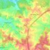
Teugn topographic map

Click on the map to display elevation.

About this map

Name: Teugn topographic map, elevation, terrain.

Location: Teugn, Saal an der Donau (VGem), Landkreis Kelheim, Bavaria, 93356, Germany (48.87200 11.96717 48.91127 12.04909)

Average elevation: 403 m

Minimum elevation: 337 m

Maximum elevation: 468 m

Other topographic maps

Click on a map to view its topography, its elevation and its terrain.

Paring

Germany > Bavaria > Landkreis Kelheim

Average elevation: 404 m

Offenstetten

Germany > Bavaria > Landkreis Kelheim

Average elevation: 385 m

Buch

Germany > Bavaria > Landkreis Kelheim

Average elevation: 447 m

Neuenkehrsdorf

Germany > Bavaria > Landkreis Kelheim > Riedenburg

Average elevation: 442 m

Gear up for your next adventure:

🧳Compression Sacks - Maximize space in your backpack by shrinking gear
🔭Outdoor Binoculars - Lightweight binoculars for birdwatching and hiking
🚲Heavy Duty Bike Lock - Secure your bike at the trailhead or during stops
🪑Insulated Seat Pad - Protect your seat from cold rocks and wet logs
💡Compact LED Flashlight - Powerful and portable flashlight for outdoor use

As an Amazon Associate, this site earns from qualifying purchases at no extra cost to you.