Geolocate

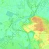
Stavern topographic map

Click on the map to display elevation.

About this map

Name: Stavern topographic map, elevation, terrain.

Location: Stavern, Samtgemeinde Sögel, Landkreis Emsland, Lower Saxony, 49777, Germany (52.73531 7.33080 52.85360 7.47689)

Average elevation: 29 m

Minimum elevation: 12 m

Maximum elevation: 65 m

Other topographic maps

Click on a map to view its topography, its elevation and its terrain.
Elbergen

Germany > Lower Saxony > Landkreis Emsland

Average elevation: 28 m

Mühlenmoor

Germany > Lower Saxony > Landkreis Emsland > Meppen > Helte

Average elevation: 17 m

Emen

Germany > Lower Saxony > Landkreis Emsland > Haren (Ems)

Average elevation: 13 m

Gear up for your next adventure:

🧢Outdoor Visor - Breathable visor for sunny hikes
🧢Beanie Hat - Keep your head warm in cold weather
🧣Evaporative Cooling Towel - Beat the heat during intense summer climbs
🥾Trekking Boots - Durable boots for long-distance trekking
🥾Trail Running Shoes - Lightweight and durable shoes for trail running

As an Amazon Associate, this site earns from qualifying purchases at no extra cost to you.