Geolocate

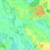
Hecklingen topographic map

Click on the map to display elevation.

About this map

Name: Hecklingen topographic map, elevation, terrain.

Location: Hecklingen, Salzlandkreis, Saxony-Anhalt, 39444, Germany (51.81010 11.32879 51.92083 11.57298)

Average elevation: 96 m

Minimum elevation: 31 m

Maximum elevation: 185 m

Other topographic maps

Click on a map to view its topography, its elevation and its terrain.

Lust

Germany > Saxony-Anhalt > Salzlandkreis > Staßfurt

Average elevation: 71 m

Gear up for your next adventure:

👟Trail Running Shoes - Agile footwear for fast-paced topographic exploration
🥾Durable Hiking Shoes - Long-lasting shoes for frequent hiking
🚑Survival Whistle - Signal for help across long distances in mountains
🧤Insulated Winter Gloves - Heavy-duty protection for sub-zero Canadian adventures
🧰Emergency Multi-Tool - Compact multi-tool for outdoor survival

As an Amazon Associate, this site earns from qualifying purchases at no extra cost to you.