Geolocate

Tübingen topographic map

Click on the map to display elevation.

About this map
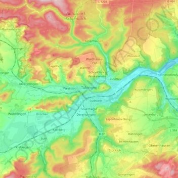
Name: Tübingen topographic map, elevation, terrain.

Location: Tübingen, Landkreis Tübingen, Baden-Württemberg, Germany (48.45058 8.96452 48.59377 9.13107)

Average elevation: 413 m

Minimum elevation: 301 m

Maximum elevation: 580 m

Other topographic maps

Click on a map to view its topography, its elevation and its terrain.
Gear up for your next adventure:

🥾Waterproof Hiking Boots - Essential footwear for rugged terrain and wet Canadian trails
🚲Handlebar Phone Mount - View topographic-map.com live while cycling
💡Portable Camping Lamp - Rechargeable lamp for campsite lighting
⛺Tent Footprint - Protect tent floor and increase durability
🧦Thermal Socks - Warm socks for winter hiking or camping

As an Amazon Associate, this site earns from qualifying purchases at no extra cost to you.