Geolocate

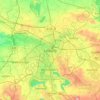
Kleinzschocher topographic map

Click on the map to display elevation.

About this map

Name: Kleinzschocher topographic map, elevation, terrain.

Location: Kleinzschocher, Südwest, Leipzig, Saxony, Germany (51.30168 12.30152 51.32097 12.34342)

Average elevation: 118 m

Minimum elevation: 106 m

Maximum elevation: 143 m

Other topographic maps

Click on a map to view its topography, its elevation and its terrain.
Leipzig

Germany > Saxony > Leipzig

Average elevation: 127 m

Tensa

Germany > Saxony > Leipzig

Average elevation: 134 m

Gear up for your next adventure:

🧥Softshell Hiking Jacket - The perfect balance of wind protection and breathability
🧦Merino Wool Socks - Moisture-wicking comfort for long-distance hiking
🎒Hiking Backpack - Lightweight and ergonomic backpacks for day hikes or multi-day treks
🎒Backpack Rain Cover - External shield to keep your entire pack dry
⛺Camping Groundsheet - Protect your tent from moisture and dirt

As an Amazon Associate, this site earns from qualifying purchases at no extra cost to you.