Geolocate

90403 topographic map

Click on the map to display elevation.

About this map

Name: 90403 topographic map, elevation, terrain.

Location: 90403, Altstadt und engere Innenstadt, Nuremberg, Bavaria, Germany (49.44986 11.06904 49.45967 11.08924)

Average elevation: 315 m

Minimum elevation: 295 m

Maximum elevation: 339 m

Other topographic maps

Click on a map to view its topography, its elevation and its terrain.
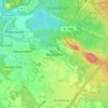
Worzeldorf

Germany > Bavaria > Nuremberg

Average elevation: 341 m

Gear up for your next adventure:

🧰Survival Kit - Essential gear for emergencies in the wilderness
⛺Family Camping Tent - Spacious tent suitable for family camping trips
🧦Crew Hiking Socks - Comfortable socks for long-distance hikes
🧴Waterproofing Spray - Restore the DWR coating on jackets and tents
🥾All-Terrain Hiking Boots - Versatile boots for varied hiking conditions

As an Amazon Associate, this site earns from qualifying purchases at no extra cost to you.