Geolocate

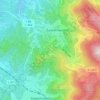
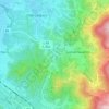
Mühlenbach topographic map

Click on the map to display elevation.

About this map

Name: Mühlenbach topographic map, elevation, terrain.

Location: Mühlenbach, VVG der Stadt Haslach im Kinzigtal, Ortenaukreis, Baden-Württemberg, 77796, Germany (48.20811 8.07165 48.26786 8.17757)

Average elevation: 468 m

Minimum elevation: 220 m

Maximum elevation: 805 m

Other topographic maps

Click on a map to view its topography, its elevation and its terrain.

Sommerseite

Germany > Baden-Württemberg > Ortenaukreis > Seebach

Average elevation: 599 m

Kernhof

Germany > Baden-Württemberg > Ortenaukreis > Seebach

Average elevation: 755 m

Schliffkopf

Germany > Baden-Württemberg > Ortenaukreis > Oppenau

Average elevation: 864 m

Waldulm

Germany > Baden-Württemberg > Ortenaukreis

Average elevation: 287 m

Hilsenhof

Germany > Baden-Württemberg > Ortenaukreis > Seebach

Average elevation: 529 m

Gear up for your next adventure:

🩹Moleskin Blister Pads - Direct protection for painful foot pressure points
🧢Beanie Hat - Keep your head warm in cold weather
💡Solar Camping Lamp - Eco-friendly lighting for campsites
🧥Waterproof Hiking Jacket - Protect yourself from rain and wind while hiking
🎒Hiking Backpack - Lightweight and ergonomic backpacks for day hikes or multi-day treks

As an Amazon Associate, this site earns from qualifying purchases at no extra cost to you.