
Butler County topographic map
Interactive map
Click on the map to display elevation.
About this map
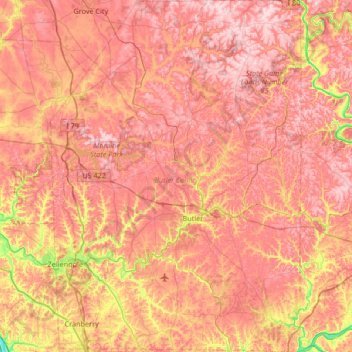
Name: Butler County topographic map, elevation, terrain.
Location: Butler County, Pennsylvania, United States (40.66905 -80.16529 41.17312 -79.69009)
Average elevation: 376 m
Minimum elevation: 205 m
Maximum elevation: 485 m
Other topographic maps
Click on a map to view its topography, its elevation and its terrain.
Graham Township
United States > Pennsylvania > Clearfield County
Graham Township, Clearfield County, Pennsylvania, 16858, United States
Average elevation: 464 m
Beaver County
Beaver County, Pennsylvania, United States
Average elevation: 325 m
Bucks County
Bucks County, Pennsylvania, United States
Average elevation: 98 m
Plain Nine Dam
United States > Pennsylvania > Blair County > Juniata Township
Plain Nine Dam, Juniata Township, Blair County, Pennsylvania, United States
Average elevation: 550 m
Mechanicsburg
United States > Pennsylvania > Cumberland County
Mechanicsburg, Cumberland County, Pennsylvania, United States
Average elevation: 135 m
Belle Vernon
United States > Pennsylvania > Fayette County
Belle Vernon, Fayette County, Pennsylvania, United States
Average elevation: 276 m
Renovo
United States > Pennsylvania > Clinton County
Renovo, Clinton County, Pennsylvania, 17764, United States
Average elevation: 378 m
Wind Gap
United States > Pennsylvania > Northampton County
Wind Gap, Northampton County, Pennsylvania, United States
Average elevation: 255 m
Hampden Township
United States > Pennsylvania > Cumberland County
Hampden Township, Cumberland County, Pennsylvania, 17050, United States
Average elevation: 138 m
Derry Township
United States > Pennsylvania > Montour County
Derry Township, Montour County, Pennsylvania, United States
Average elevation: 190 m
Paxtonia
United States > Pennsylvania > Dauphin County > Lower Paxton Township
Paxtonia, Lower Paxton Township, Dauphin County, Pennsylvania, United States
Average elevation: 151 m
South Beaver Township
United States > Pennsylvania > Beaver County
South Beaver Township, Beaver County, Pennsylvania, 16115, United States
Average elevation: 332 m
Cresson
United States > Pennsylvania > Cambria County
Cresson, Cambria County, Pennsylvania, 16630, United States
Average elevation: 637 m
Upper Mifflin Township
United States > Pennsylvania > Cumberland County
Upper Mifflin Township, Cumberland County, Pennsylvania, United States
Average elevation: 244 m
Newville
United States > Pennsylvania > Bucks County > New Britain Township
Newville, New Britain Township, Bucks County, Pennsylvania, 18194, United States
Average elevation: 109 m
Standing Stone Township
United States > Pennsylvania > Bradford County
Standing Stone Township, Bradford County, Pennsylvania, United States
Average elevation: 335 m
Phelps Corners
United States > Pennsylvania > Erie County
Phelps Corners, Waterford Township, Erie County, Pennsylvania, United States
Average elevation: 453 m
Fern Glen
United States > Pennsylvania > Luzerne County > Black Creek Township
Fern Glen, Black Creek Township, Luzerne County, Pennsylvania, 18246, United States
Average elevation: 391 m
Allentown
United States > Pennsylvania > Lehigh County
Allentown, Lehigh County, Pennsylvania, United States
Average elevation: 129 m
Lodi
United States > Pennsylvania > Bucks County > Tinicum Township
Lodi, Tinicum Township, Bucks County, Pennsylvania, 18972, United States
Average elevation: 93 m
Silver Spring Township
United States > Pennsylvania > Cumberland County
Silver Spring Township, Cumberland County, Pennsylvania, 17072, United States
Average elevation: 148 m
New Castle
United States > Pennsylvania > Lawrence County
New Castle, Lawrence County, Pennsylvania, 16101, United States
Average elevation: 296 m
Palomino Farms
United States > Pennsylvania > Bucks County > Warrington Township
Palomino Farms, Warrington Township, Bucks County, Pennsylvania, 18976, United States
Average elevation: 93 m
Warrington Township
United States > Pennsylvania > Bucks County
Warrington Township, Bucks County, Pennsylvania, 18976, United States
Average elevation: 87 m
Lower Makefield Township
United States > Pennsylvania > Bucks County > Lower Makefield Township
Lower Makefield Township, Bucks County, Pennsylvania, 19067, United States
Average elevation: 44 m
Chambersburg
United States > Pennsylvania > Franklin County
Chambersburg, Franklin County, Pennsylvania, United States
Average elevation: 200 m
Doylestown Township
United States > Pennsylvania > Bucks County
Doylestown Township, Bucks County, Pennsylvania, 18923, United States
Average elevation: 94 m
Alsace Township
United States > Pennsylvania > Berks County
Alsace Township, Berks County, Pennsylvania, United States
Average elevation: 231 m
Lycoming Township
United States > Pennsylvania > Lycoming County
Lycoming Township, Lycoming County, Pennsylvania, United States
Average elevation: 284 m
Coaldale
United States > Pennsylvania > Schuylkill County
Coaldale, Schuylkill County, Pennsylvania, United States
Average elevation: 360 m
Eldred Township
United States > Pennsylvania > Monroe County
Eldred Township, Monroe County, Pennsylvania, United States
Average elevation: 264 m
Delta
United States > Pennsylvania > York County
Delta, York County, Pennsylvania, United States
Average elevation: 154 m
Confluence
United States > Pennsylvania > Somerset County
Confluence, Somerset County, Pennsylvania, United States
Average elevation: 459 m
Doylestown
United States > Pennsylvania > Bucks County
Doylestown, Bucks County, Pennsylvania, 18901, United States
Average elevation: 108 m
Adams Run
United States > Pennsylvania > Bedford County > East Saint Clair Township
Adams Run, East Saint Clair Township, Bedford County, Pennsylvania, 15539, United States
Average elevation: 361 m
West Hemlock Township
United States > Pennsylvania > Montour County
West Hemlock Township, Montour County, Pennsylvania, United States
Average elevation: 258 m
Ohiopyle
United States > Pennsylvania > Fayette County
Ohiopyle, Fayette County, Pennsylvania, United States
Average elevation: 457 m
Grimesville
United States > Pennsylvania > Lycoming County > Old Lycoming Township
Grimesville, Old Lycoming Township, Lycoming County, Pennsylvania, 17702, United States
Average elevation: 203 m
Mainland
United States > Pennsylvania > Montgomery County > Lower Salford Township
Mainland, Lower Salford Township, Montgomery County, Pennsylvania, 19451, United States
Average elevation: 79 m
Upper Southampton Township
United States > Pennsylvania > Bucks County
Upper Southampton Township, Bucks County, Pennsylvania, 19407, United States
Average elevation: 74 m
Ranger Lake
United States > Pennsylvania > Lehigh County > North Whitehall Township > Ormrod
Ranger Lake, Ormrod, North Whitehall Township, Lehigh County, Pennsylvania, United States
Average elevation: 127 m
Lumberville
United States > Pennsylvania > Bucks County > Solebury Township
Lumberville, Solebury Township, Bucks County, Pennsylvania, 18933, United States
Average elevation: 88 m
Pomeroy
United States > Pennsylvania > Chester County > Sadsbury Township
Pomeroy, Sadsbury Township, Chester County, Pennsylvania, 19367, United States
Average elevation: 175 m
Philadelphia
Philadelphia, Pennsylvania, 19140, United States
Average elevation: 68 m
Pleasant Hills
United States > Pennsylvania > Allegheny County
Pleasant Hills, Allegheny County, Pennsylvania, United States
Average elevation: 340 m
Forestville
United States > Pennsylvania > Chester County > Upper Oxford Township
Forestville, Upper Oxford Township, Chester County, Pennsylvania, 19352, United States
Average elevation: 150 m
Big Beaver
United States > Pennsylvania > Beaver County
Big Beaver, Beaver County, Pennsylvania, 16141, United States
Average elevation: 324 m
Warrendale
United States > Pennsylvania > Allegheny County
Warrendale, Marshall Township, Allegheny County, Pennsylvania, 15086, United States
Average elevation: 359 m
New Mines
United States > Pennsylvania > Schuylkill County > Reilly Township
New Mines, Reilly Township, Schuylkill County, Pennsylvania, 17923, United States
Average elevation: 338 m
Somerset Township
United States > Pennsylvania > Washington County
Somerset Township, Washington County, Pennsylvania, United States
Average elevation: 347 m