Geolocate

Delta topographic map

Click on the map to display elevation.

About this map

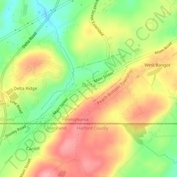
Name: Delta topographic map, elevation, terrain.

Location: Delta, York County, Pennsylvania, United States (39.72114 -76.33718 39.73178 -76.31898)

Average elevation: 154 m

Minimum elevation: 94 m

Maximum elevation: 209 m

Gear up for your next adventure:

🥾Light Trekking Boots - Supportive boots for multi-day treks
🥾Trekking Boots - Durable boots for long-distance trekking
🥾Trail Hiking Socks - Comfortable socks to prevent blisters and fatigue
🩹Moleskin Blister Pads - Direct protection for painful foot pressure points
🥾Waterproof Hiking Shoes - Durable shoes for wet and rugged trails

As an Amazon Associate, this site earns from qualifying purchases at no extra cost to you.