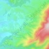
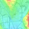
Briviesca topographic map
Click on the map to display elevation.
Briviesca
On Tuesday of Holy Week, after the afternoon mass, a Penitential Way of the Cross is celebrated through the streets of the city with three processions: "The Nazarene", "The Holy Christ of the Atonement", and "The Solitude of Our Lady", followed by the Bugle and Drum Band, created in 2012. After the mass, concerts, and the vigil of Holy Thursday, a Via-Crucis is celebrated on Good Friday morning in which the "Penitential Cross", six metres long, two metres wide and 160 kg, is carried up to the 'Monte de Los Pinos' as if it were the Mount of Calvary. The descent of the Cross is represented. In the afternoon, the 'Santos Oficios' are celebrated and, at night, the maximum expression of the Holy Week takes place; the 'Santo Entierro' Procession. It is the most spectacular and multitudinous one. Thirteen floats and around three hundred brothers in the habit parade: "Prayer in the Garden", "Flagellation of the Lord", "Ecce Homo", "Penitential Cross", "The Nazarene", "The Veronica", "Elevation of the Cross", "Holy Christ of the Atonement", "The Descent", "The Pietà", "Santo Sepulcro", "Apóstol San Juan" and "La Dolorosa" accompanied by the Municipal Music Band, the Bugle and Drum Band of the Holy Confraternity of the Vera-Cruz, and various civil and ecclesiastical authorities. In this procession the silence broken by the music is the main characteristic, as well as the parade that takes place in the Plaza Mayor to interpret Schubert's Ave Maria. It ends with the singing of the Salve Popular and the transfer of the 'Santo Sepulcro' to the Church of San Martín.
About this map

Name: Briviesca topographic map, elevation, terrain.
Location: Briviesca, Burgos, Castile and León, 09240, Spain (42.48045 -3.42664 42.61327 -3.22168)
Average elevation: 793 m
Minimum elevation: 639 m
Maximum elevation: 1,052 m
Other topographic maps
Click on a map to view its topography, its elevation and its terrain.








Monte Bernorio
Spain > Castile and León > Pomar de Valdivia
The Monte Bernorio is an elevation located next to the town of Villarén de Valdivia, in the north of the province of Palencia (Spain) where important archaeological remains have been found, as well as the remains of a fortified Cantabrian city, which exceeds 120 ha and is one of the largest found in Spain and…
Average elevation: 1,017 m


Valtuille de Abajo
Spain > Castile and León > El Bierzo > Villafranca del Bierzo
Average elevation: 525 m


Ávila
Ávila is the capital and most populated municipality of the Province of Ávila, located in the autonomous community of Castile and León in Spain. Located in the centre of the Iberian Peninsula, to the north of the Sistema Central, it lies on the right bank of the Adaja and, at an elevation of over 1,130…
Average elevation: 1,167 m




Sierra de Guadarrama
The range runs southwest–northeast, extending from the province of Ávila in the southwest, through the Community of Madrid, to the province of Segovia in the northeast. The range measures approximately 80 kilometres (50 mi) in length. Its highest peak is Peñalara, 2,428 metres (7,966 ft) in elevation.
Average elevation: 1,153 m
Yacimiento arqueológico La Edrada
Spain > Castile and León > El Bierzo > Cacabelos
Average elevation: 493 m
Poblado del Salto de Aldeadávila
Spain > Castile and León > Aldeadávila de la Ribera
Average elevation: 535 m